

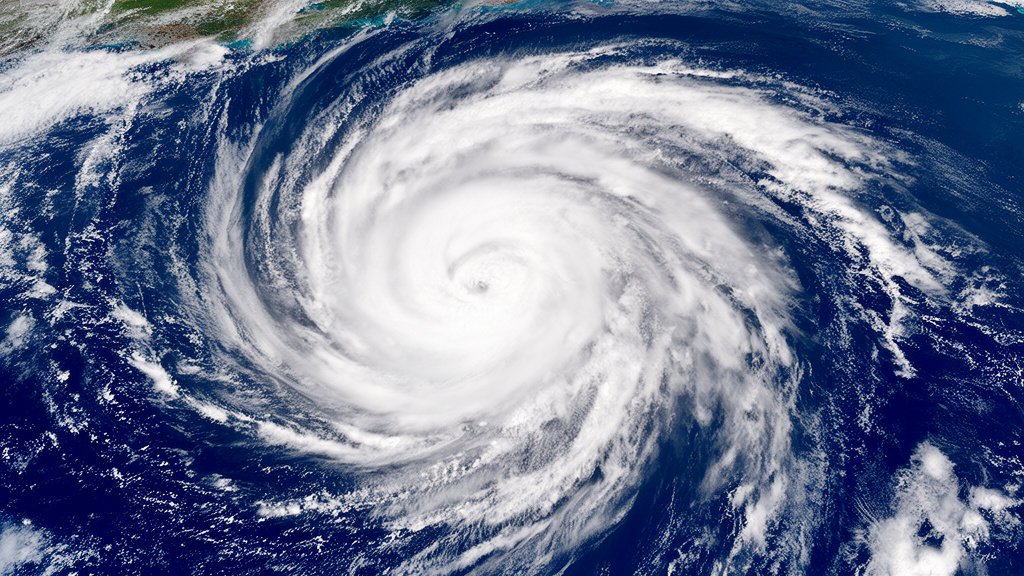
As Tropical Storm Isaias gains momentum in the Gulf of Mexico, the latest atmospheric data indicates the system is currently tracking east of Texas. While the storm is showing clear signs of intensifying, the current trajectory suggests it will move away from the Texas coastline, offering the state a period of drier conditions as the system consolidates energy and prepares for potential hurricane status. Meteorological agencies are closely monitoring the system, which remains the primary focus for coastal preparedness and maritime traffic in the Gulf.
- Gulf Formation: Tropical Storm Isaias has officially reached tropical storm status within the Gulf of Mexico, characterized by strengthening winds and a defined cyclonic structure.
- Tracking and Trajectory: Current forecasting models show the storm tracking east, steering clear of a direct landfall in Texas, which is expected to result in drier weather patterns for the state.
- Intensification Forecast: Meteorologists anticipate the system will continue to organize and intensify, with projections indicating it is likely to reach hurricane status within the coming days as it moves across the warmer waters of the Gulf.
Navigating the Gulf: Atmospheric Dynamics and Path Projections
The development of Tropical Storm Isaias presents a classic case study in Gulf of Mexico weather patterns, where warm sea surface temperatures provide a potent fuel source for cyclonic intensification. For residents and emergency management officials in Texas, the current tracking represents a significant turn of events. Rather than the typical threat of widespread flooding and tropical rainfall associated with such systems, the east-ward drift of Isaias is expected to create a subsidence zone. This atmospheric setup is likely to suppress convective activity across parts of Texas, allowing for a temporary dry spell even as the region remains sensitive to broader drought concerns.
Meteorological Mechanics of the Shift
The steering currents influencing Isaias are being driven by a high-pressure ridge situated over the central United States. This ridge acts as a metaphorical wall, preventing the storm from pushing westward. Instead, the storm is being nudged toward the east, following the weakness in the atmospheric pressure gradient. Meteorologists at the National Hurricane Center (NHC) are utilizing satellite imagery and reconnaissance aircraft to measure the storm’s central pressure and wind velocity. The rapid organization of the cloud structure suggests that the system is successfully drawing heat energy from the Gulf waters, which are currently running significantly above the historical averages for this time of year.
The Texas Drier Condition Paradox
While the prospect of a hurricane in the Gulf typically signals danger, the spatial relationship between the storm’s core and the Texas coastline is providing a specific, localized weather anomaly. Often, tropical systems pull moisture away from surrounding areas, creating an “outflow” of sinking air on the periphery. In this scenario, the outer bands of Isaias are not extending into the Texas plains. Consequently, the state is seeing a reduction in cloud cover and precipitation. While this may seem like a positive turn for those avoiding flood risk, it highlights the delicate nature of Texas’s hydrological cycle, where a lack of tropical rainfall can quickly transition into renewed drought conditions in the late summer heat.
Hurricane Potential and Preparation
As the system continues its journey, the focus shifts to the Saffir-Simpson Hurricane Wind Scale. Forecasters are looking for the development of a distinct “eye” feature and sustained wind speeds exceeding 74 mph. Should the system maintain its current trajectory and speed, it is expected to reach hurricane status before interacting with the next set of environmental variables, such as vertical wind shear. Maritime interests, including commercial shipping and oil infrastructure in the Gulf, are already shifting operations to account for the tightening of the storm’s internal structure. Emergency preparedness remains at a heightened state, as even minor deviations in the storm’s path can have major implications for coastal regions further east.
FAQ: People Also Ask
Q: Why is Isaias moving east instead of toward Texas?
A: The storm’s movement is primarily governed by steering currents—large-scale wind patterns in the atmosphere. A high-pressure ridge currently located over the central U.S. is effectively blocking a westward path, forcing the system to track to the east.
Q: Does ‘drier conditions’ mean the drought is worsening?
A: While short-term dry weather is expected, it is a localized impact of the storm’s circulation. Texas drought conditions are complex, but the lack of expected tropical moisture does prevent the immediate relief that such storms typically bring to the state’s reservoirs.
Q: What is the likelihood of Isaias becoming a hurricane?
A: Meteorological agencies, including the National Hurricane Center, currently forecast a high probability of intensification. With favorable sea surface temperatures and low vertical wind shear in the immediate path, the system is expected to meet the criteria for a hurricane as it moves through the Gulf.
Q: What should coastal residents do even if the storm is tracking east?
A: Residents should continue to monitor official reports from the National Hurricane Center. Tropical cyclone paths can be unpredictable, and peripheral effects like rip currents and high surf can occur even when the center of the storm is far offshore.