
Tropical Storm Edouard has officially made landfall, moving inland across Southeast Texas and presenting a sustained, severe weather challenge for the Houston metropolitan region. As the system tracks across the state, local authorities are prioritizing the mitigation of persistent heavy rainfall that threatens to overwhelm drainage capacity and trigger localized flash flooding. With the storm’s impact expected to linger through Wednesday, the Houston Office of Emergency Management (OEM) has moved to a heightened state of readiness, urging residents to remain vigilant and avoid unnecessary travel until the weather front fully clears the region.
Key Highlights
- Storm Progression: Tropical Storm Edouard is currently pushing inland, with its influence extending across the Southeast Texas corridor.
- Primary Threat: The most critical concern for Houston is the accumulation of heavy rainfall, which creates a high probability of flash flooding in low-lying areas and underpasses.
- Timeline: Adverse weather conditions and flood risks are anticipated to persist through Wednesday.
- Emergency Directives: Officials from the Houston OEM and local law enforcement are advising residents to monitor local weather channels and avoid flooded roadways, strictly adhering to the “Turn Around, Don’t Drown” protocol.
Navigating the Storm: Houston’s Infrastructure and Emergency Resilience
The arrival of Tropical Storm Edouard serves as a significant stress test for the Houston area’s infrastructure, a region notoriously susceptible to the hydrological challenges posed by flat topography and intense precipitation events. As the storm tracks inland, the convergence of meteorological data and urban management strategies becomes the central focus for city planners, first responders, and the general public. The situation requires a multi-layered response, integrating immediate safety protocols with long-term infrastructure considerations.
The Mechanics of the Rainfall and Meteorological Threat
Unlike faster-moving weather systems, Tropical Storm Edouard is exhibiting characteristics that allow for prolonged precipitation. Meteorologists indicate that the storm’s inland movement is slowed by regional atmospheric pressures, which facilitates a “training” effect—where rain bands repeatedly pass over the same geographic areas. For Houston, this is the most precarious scenario. When rainfall rates exceed the saturation capacity of the ground and the flow capacity of the bayou system, the result is immediate surface flooding. The National Weather Service (NWS) has emphasized that urbanized areas with high percentages of impervious surfaces—such as concrete and asphalt—are at the highest risk, as these surfaces prevent water absorption and accelerate runoff into stormwater management systems.
Infrastructure Readiness: The Role of Bayou Systems
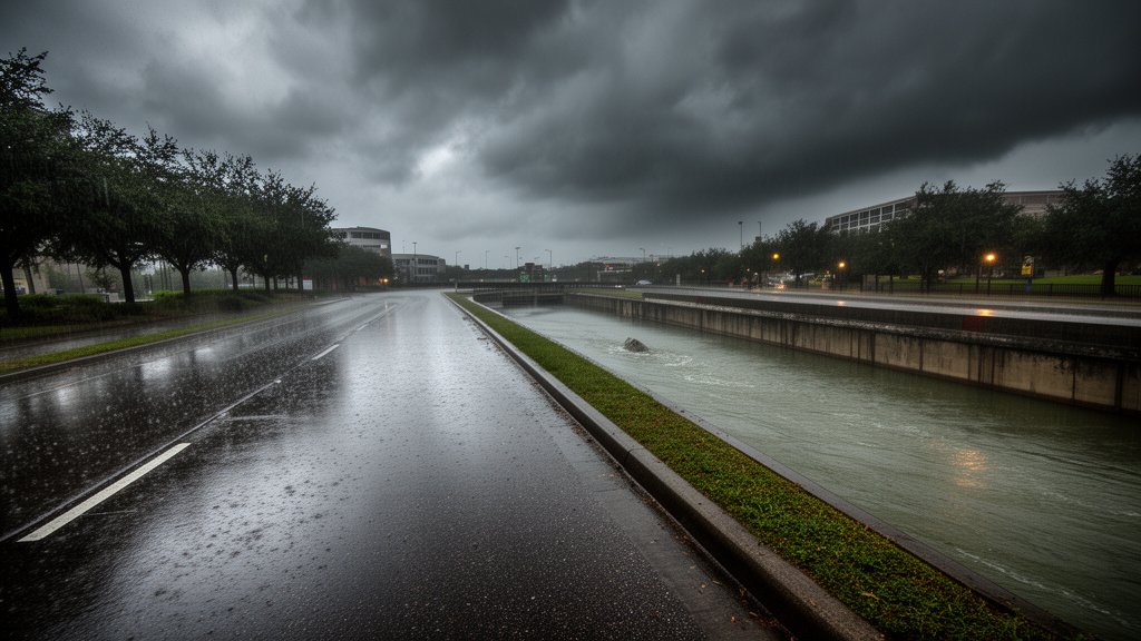
Central to Houston’s defense are the Harris County Flood Control District’s (HCFCD) extensive drainage networks and bayou systems. These man-made and natural channels are the lifeline of the city’s flood mitigation strategy. During events like Edouard, these channels function as the primary conveyance mechanism for stormwater exiting the urban core. Current reports indicate that while capacity remains available, the intensity of the projected rainfall through Wednesday requires continuous monitoring of water levels. Engineers are actively managing detention basins and flood-control infrastructure to modulate flow rates, preventing sudden overflow. The operational integrity of these systems is critical; however, even the most robust drainage architecture faces limitations during high-volume precipitation events, necessitating strict public adherence to emergency directives.
Emergency Management and Public Safety Protocols
The Houston Office of Emergency Management (OEM) has been the central coordination hub for the response. They have deployed automated alert systems to push real-time data to mobile devices, warning of specific flood-prone zones. A core secondary angle of this crisis is the logistical challenge of maintaining emergency vehicle mobility. When arterial roads become inundated, the response time for medical and fire services is significantly compromised. Consequently, local authorities have advised against all non-essential travel. The “Turn Around, Don’t Drown” directive is not merely a slogan but a critical safety measure, as the majority of flood-related fatalities occur in vehicles attempting to traverse flooded thoroughfares where depth and road integrity are obscured by murky water.
Secondary Angles: Economic Impact and Long-term Urban Planning
Beyond the immediate meteorological threat, Tropical Storm Edouard forces a recurring conversation regarding Houston’s long-term economic resilience. Economic disruption is a tertiary effect of such storms; supply chain logistics, port access, and local business operations are frequently halted during these high-alert periods. As the region navigates this latest event, urban planners are analyzing the effectiveness of recent flood-bond-funded projects. This involves evaluating whether new detention basins and infrastructure upgrades are performing to specification. The storm acts as a real-world data point for future resilience modeling. Furthermore, there is a socio-economic angle to address: the disparate impact of flooding on different neighborhoods. Resources are being allocated to ensure that vulnerable communities, which often reside in lower-elevation areas, receive prioritized support and communication to mitigate risk.
Predictive Modeling and Future Resilience
Looking toward the conclusion of the storm’s transit on Wednesday, the focus will shift from immediate response to recovery and damage assessment. Predictive models suggest that once the system exits, the primary concern shifts to riverine flooding—where water continues to collect in downstream bayous even after the rain ceases. This necessitates a phased approach to the ‘all-clear’ notification. Resilience, in this context, is defined by the speed of the city’s recovery and the ability of residents to adapt to these increasingly frequent climate-driven events. Through investment in green infrastructure, such as permeable pavement and expanded detention, the city aims to incrementally increase its capacity to withstand the meteorological volatility brought by systems like Edouard.
FAQ: People Also Ask
Q: What is the primary flood risk for the Houston area during this storm?
A: The primary risk is flash flooding, caused by intense, persistent rainfall that exceeds the capacity of municipal drainage systems and bayous, particularly in low-lying areas.
Q: How long will the impacts of Tropical Storm Edouard last?
A: Authorities are monitoring the situation and anticipate weather impacts and elevated flood risks to continue through Wednesday before the system moves fully out of the region.
Q: What should I do if I encounter a flooded road while driving?
A: Do not attempt to drive through flooded roadways. The depth of the water and the condition of the road beneath it can be deceptive. Follow the ‘Turn Around, Don’t Drown’ safety protocol and find an alternate, safer route.
Q: Where can I get official updates for my specific neighborhood?
A: Residents should monitor the official Houston Office of Emergency Management (OEM) social media channels, the Harris County Flood Control District’s website, and local television and radio news outlets for hyper-local emergency information.