
Governor Greg Abbott has issued a stern warning to residents to prepare for severe weather, as meteorologists track a slow-moving cold front that is expected to tap into deep tropical moisture, causing widespread flash flooding across Texas this week. The state government has moved to a high state of readiness, with emergency resources being pre-positioned to assist local jurisdictions as they brace for potentially life-threatening precipitation.
Key Highlights
- State of Readiness: Governor Abbott has directed the Texas Division of Emergency Management (TDEM) to increase the operational readiness of state emergency response resources.
- Meteorological Threat: A rare convergence of a stagnant cold front and high-volume tropical moisture is creating a high risk for rapid, localized flooding.
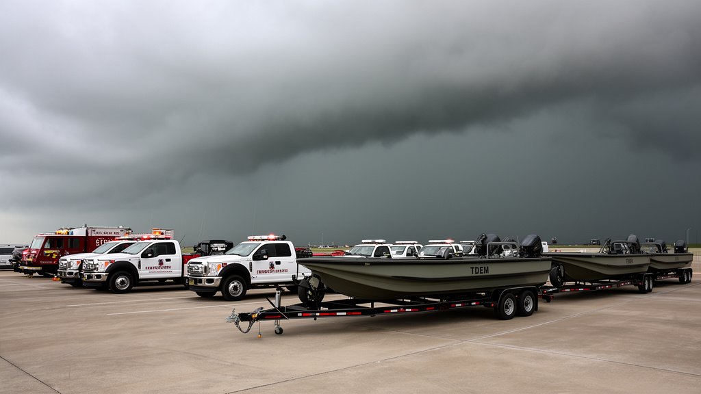
- Emergency Deployment: Specialized water rescue teams, high-water vehicles, and boat squads have been staged in areas identified as most vulnerable.
- Public Safety Warning: Officials are urging residents to avoid driving through standing water and to monitor local National Weather Service (NWS) alerts throughout the duration of the weather event.
Safeguarding the Lone Star State: The Emergency Response
The current weather event, characterized by a slow-moving cold front interacting with high concentrations of tropical moisture, presents a dual threat of high-intensity rainfall and prolonged downpours. Governor Greg Abbott’s directive to the Texas Division of Emergency Management (TDEM) signals a proactive, rather than reactive, approach to disaster management. By pre-positioning assets—including Swiftwater Rescue boat squads, high-profile vehicle strike teams, and medical support units—the state is attempting to minimize the lag time between a flash flood event and the delivery of critical aid.
The Meteorological Mechanism
Understanding the severity of this system requires looking at the atmospheric dynamics at play. When a cold front, which typically acts as a “plow” to push moisture out of an area, stalls over a region rich with tropical moisture—often drawn from the Gulf of Mexico—the result is an “atmospheric training” effect. This phenomenon occurs when repeated storms move over the same geographical location, similar to train cars following the same track. This results in rainfall totals that can rapidly overwhelm local drainage infrastructure, turning urban streets into torrents and rural roadways into impassable channels within minutes.
Infrastructure and Economic Implications
Flash flooding carries significant economic weight beyond the immediate threat to life and limb. Texas, with its vast agricultural sector and dense urban metropolitan centers, is particularly vulnerable. In rural areas, flash flooding can lead to the inundation of crops, the loss of livestock, and the destruction of critical secondary road networks that are essential for transport. In cities like Houston, Dallas, and Austin, the economic impact is felt through the paralysis of logistics networks, the flooding of commercial facilities, and the long-term cost of infrastructure repair. State officials are keenly aware that early mobilization of resources helps mitigate these costs by protecting both private property and public works.
Historical Context of Texas Flooding
Texas has a long, documented history with flash flood events. The state’s unique geography, ranging from the Gulf Coast to the rolling hills of the Hill Country, creates varied hydrological challenges. Flash floods here are often intensified by the terrain; in the Hill Country, steep limestone bluffs can cause water to funnel rapidly into low-lying canyons, creating “rise-time” events that give residents very little warning. Governor Abbott’s administration is emphasizing that these historical trends have informed current emergency planning, with lessons learned from previous disasters now codified into the standard operating procedures of the TDEM.
Future Predictions and Climate Resilience
Climate experts and meteorologists increasingly point to a trend of “intensification” in Texas weather patterns. While individual storms are complex, the trend toward higher volumes of rainfall in shorter periods—often referred to as “hydrological volatility”—is a growing concern. This current warning is not an isolated incident but part of a broader strategy to increase the state’s resilience. Investing in flood mitigation projects, updating storm drainage systems, and fostering a culture of public awareness regarding flood safety are the pillars of the state’s long-term flood defense strategy.
FAQ: People Also Ask
Q: What should I do if I see water over the road?
A: The absolute rule is “Turn Around, Don’t Drown.” Never attempt to drive through flooded roadways. Just six inches of fast-moving water can knock over an adult, and twelve inches of flowing water can carry away a small vehicle. If you see water covering a road, assume the roadbed underneath may be washed out.
Q: Where can I get the most accurate, localized flood alerts?
A: You should monitor the National Weather Service (NWS) official website (weather.gov) and your local NWS office’s social media channels. Additionally, sign up for your county’s emergency alert system, which often provides text-based notifications specific to your exact address.
Q: How does the Texas Division of Emergency Management (TDEM) decide where to send resources?
A: TDEM utilizes predictive modeling provided by the NWS and the National Oceanic and Atmospheric Administration (NOAA). They analyze soil saturation levels, rainfall intensity forecasts, and historical flood maps to identify “hot zones” before the rain actually starts, ensuring resources are staged where they are mathematically most likely to be needed.
Q: Is this flooding related to a specific tropical system?
A: The current advisory is based on a slow-moving cold front pulling in tropical moisture. While it is not necessarily a named tropical storm, the moisture content is tropical in origin, which makes the rainfall particularly efficient and heavy. Always defer to local officials regarding whether a system has been upgraded to a tropical depression or storm.