
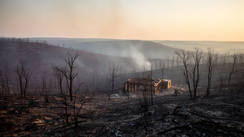
The Ross Fire has emerged as a catastrophic event in North Central Texas, leaving a scar of 78 square miles across the rugged topography of Palo Pinto County. Fueled by dry vegetation and high-speed winds, the inferno tore through private ranchlands and recreational properties, forcing local authorities to issue immediate evacuation orders and triggering emergency school closures. As the smoke clears, the extent of the damage is becoming painfully apparent, with multiple structures—including a youth camp facility—confirmed destroyed in the fire’s path.
Key Highlights
- Massive Acreage Burned: The wildfire has officially consumed approximately 78 square miles (roughly 50,000 acres) of land, marking it as one of the most significant fire events in the region for the current season.
- Critical Structural Loss: Dozens of structures have been confirmed destroyed, with reports highlighting the loss of cabins and facilities at a popular regional youth camp.
- Immediate Community Impact: Palo Pinto County authorities issued mandatory evacuation orders, and local school districts were forced to close due to air quality concerns and safety risks.
- Emergency Response: Resources from the Texas A&M Forest Service, alongside local volunteer fire departments, have been battling the blaze, prioritizing containment in extremely difficult, rocky terrain.
The Anatomy of a Raging Inferno
The ignition of the Ross Fire serves as a stark reminder of the vulnerability of North Texas ranchlands during periods of intense atmospheric dryness. Palo Pinto County, known for its diverse terrain ranging from flat pastures to steep, wooded canyons, presented a unique challenge to first responders. When the fire began, it moved with a ferocity that caught many residents off guard, fueled by an accumulation of dead brush and invasive grasses that acted as kindling under the mid-day sun.
The Human and Structural Toll
While the primary concern for incident commanders has been the protection of human life, the material losses are significant. The destruction of the youth camp facility has been particularly heart-wrenching for the local community. For generations, this camp served as a cornerstone of youth development, providing a space for summer activities and educational programs. The loss of these structures represents more than just a real estate impact; it is a loss of cultural and social heritage for the families who utilized the space.
Challenges in Rural Firefighting
Battling a fire of this magnitude in rural Palo Pinto County involves complex logistics. Unlike suburban firefighting, where hydrants and municipal infrastructure are readily available, wildfire suppression in ranch country relies on water tankers, heavy machinery to create firebreaks, and aerial support. The terrain often prevents large vehicles from reaching the fire front, forcing firefighters to rely on manual, grueling labor in extreme heat. The coordination between the Texas A&M Forest Service and local county units is a delicate balance of strategy, ensuring that limited resources are deployed where they can save the most assets.
Economic and Environmental Implications
Beyond the immediate tragedy of property loss, the economic implications for North Texas are profound. The region is heavily dependent on ranching and agricultural output. The fire did not merely burn fences and sheds; it incinerated prime grazing land that will take months, if not years, to recover to a state suitable for livestock. Ranchers are now facing the immediate cost of relocating livestock, finding supplemental feed, and replacing destroyed infrastructure. This fire highlights the fragility of the agricultural supply chain when faced with erratic climate events.
The Drought-Fire Connection
Climate analysis suggests that the North Texas region has been suffering from prolonged precipitation deficits. This drought condition reduces the moisture content in living vegetation, effectively turning the landscape into a tinderbox. Scientific monitoring of the Palo Pinto ecosystem shows that even short-term droughts, when coupled with seasonal wind spikes, create conditions where a small spark can lead to an uncontrolled, miles-long wildfire event within hours. This incident forces a broader conversation about land management policies, the implementation of fire-resistant grazing practices, and the need for earlier detection systems in remote areas.
Future Mitigation Strategies
As the region looks toward recovery, the focus is shifting from immediate response to long-term mitigation. Local government entities are already discussing the necessity of improved early warning systems and increased investment in regional wildfire response infrastructure. There is a growing consensus that the “business as usual” approach to wildfire management is becoming insufficient as fire seasons appear to lengthen and intensify. Creating defensible space around rural properties and investing in satellite-based thermal monitoring are being proposed as essential upgrades for the county’s disaster preparedness portfolio.
FAQ: People Also Ask
Q: How many acres did the Ross Fire burn?
A: The Ross Fire has consumed approximately 78 square miles, which equates to roughly 50,000 acres, causing significant disruption across Palo Pinto County.
Q: Were there any injuries reported in the Ross Fire?
A: While officials have prioritized the safety of residents and responders, the primary focus has been on evacuations. Ongoing reports are monitoring the situation for injuries, though the immediate confirmed impact is centered on property and structural damage.
Q: Why was the youth camp significant?
A: The youth camp facility provided critical space for community and youth engagement programs. Its destruction represents a major loss of local infrastructure and community heritage.
Q: What is being done to prevent further fires in Palo Pinto County?
A: Authorities are working closely with the Texas A&M Forest Service to establish firebreaks and manage fuel loads. Officials also strongly encourage property owners to maintain defensible space and adhere to local burn bans during dry conditions.