

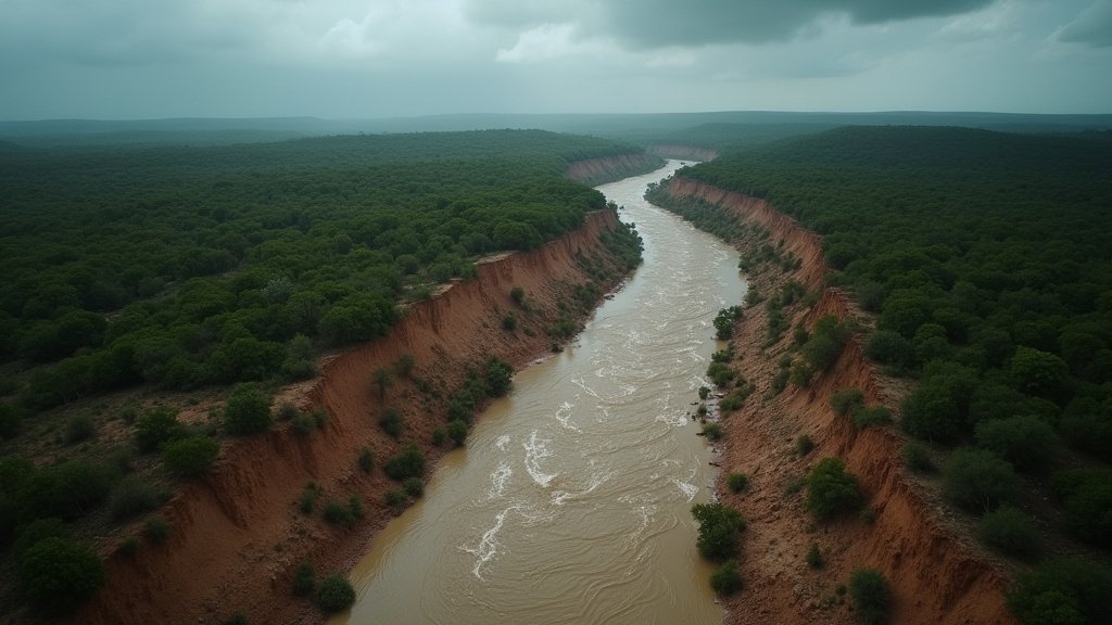
Central Texas is currently experiencing a drenching from slow-moving storms, prompting flood alerts across areas including San Antonio, Austin, and Houston suburbs. Some regions have already received up to 10 inches of rain, with the potential for life-threatening flooding persisting through Thursday. The Texas Hill Country, west of San Antonio, could see as much as 20 inches of rain by the end of the week. This heavy rainfall follows closely on the heels of severe floods that occurred last July, claiming at least 160 lives, with many lost at Camp Mystic. In response to the current threat, Governor Greg Abbott has declared a disaster in 59 counties and bolstered emergency services. The National Weather Service (NWS) has issued stark warnings, emphasizing that the region’s already saturated ground will lead to rapid runoff and dangerous flooding. Rainfall rates in some areas could exceed 4 inches per hour. Road closures have been reported, and moderate to major flooding is already occurring in several rivers.
Key Highlights:
- Imminent Flood Threat: Central Texas is under flood alerts due to heavy, slow-moving storms, with life-threatening conditions possible through Thursday.
- Historical Context: The current rainfall comes one year after devastating July floods that resulted in at least 160 fatalities.
- Governor’s Action: Governor Greg Abbott has declared a disaster in 59 Texas counties and mobilized emergency resources.
- Extreme Rainfall Potential: The Texas Hill Country may receive up to 20 inches of rain, with some areas already experiencing 10 inches.
- NWS Warnings: Saturated ground heightens the risk of rapid runoff and dangerous flooding, with potential for over 4 inches of rain per hour.
Texas’s Vulnerability to Extreme Rainfall and Flooding
A Pattern of Peril
Texas, particularly its central and Hill Country regions, has demonstrated a recurring vulnerability to extreme rainfall events. The current deluge, with potential accumulations of up to 20 inches in the Hill Country, serves as a stark reminder of the devastating floods that impacted the state in July of the previous year. During that catastrophic event, at least 160 lives were lost, including many at Camp Mystic, highlighting the extreme danger these weather patterns pose. The landscape of the Hill Country, characterized by steep slopes, shallow soils, and exposed bedrock, exacerbates flooding risks by reducing the ground’s ability to absorb heavy rainfall. This geological makeup leads to rapid runoff, overwhelming local waterways and infrastructure with alarming speed. Governor Greg Abbott’s declaration of a disaster in 59 counties underscores the severity of the current situation and the state’s preparedness efforts. The activation of emergency services, including water rescue teams and helicopters, signals a proactive approach to mitigating potential loss of life and property damage. The National Weather Service’s warnings about saturated ground and rainfall rates exceeding 4 inches per hour emphasize the life-threatening nature of the current storm system. The NWS also noted that extreme rainfall events are becoming more common due to climate change, as warmer air holds more moisture.
Lessons from the July 2025 Flood Disaster
Exactly one year prior to the current alerts, the Texas Hill Country experienced one of the deadliest inland flooding events in U.S. history. The July 4-5, 2025, floods, triggered by a mesoscale convective vortex enhanced with tropical moisture, resulted in at least 139 fatalities. Kerr County was particularly devastated, with the Guadalupe River rising an astonishing 26 feet in just 45 minutes. Over 20 children were reported missing from a summer camp in the Hunt area. The rainfall totals during this event were staggering, with some areas receiving up to 20.33 inches. This disaster led to significant damage, estimated at $1.1 billion USD. In the aftermath, Texas legislators acted swiftly, passing new laws to enhance summer camp safety, including the installation of storm sirens along the Guadalupe River. However, questions regarding accountability and the effectiveness of warning systems persist. The National Weather Service (NWS) had issued a flood watch for Kerr County more than 24 hours before the 2025 flooding, but the intensity and speed of the event overwhelmed many communities. The role of soil conditions, particularly the thin layer of soil over granite and limestone in the Hill Country, was identified as a key factor in the rapid and severe flooding. The scale of the disaster prompted a major disaster declaration by President Donald Trump for Kerr County and a visit from Governor Greg Abbott to the flood-damaged areas.
Current Preparedness and Warnings
In anticipation of the current heavy rainfall, Texas Governor Greg Abbott activated the state’s emergency response on Sunday, July 14, 2026, making state resources such as water rescue teams and helicopters readily available. The governor’s office issued a strong advisory urging citizens never to drive or walk through flooded roadways, as floodwaters can be deceptively deep and swift. The National Weather Service has issued flood watches for nearly six million people across central and southwest Texas, encompassing major cities like Austin, Del Rio, San Angelo, and San Antonio. A Level 3 of 4 flash flood risk has been issued through Wednesday by the Weather Prediction Center for the area stretching from San Antonio west to the Hill Country, Edwards Plateau, and the Rio Grande Valley near the U.S.-Mexico border. There is a possibility of this being upgraded to a rare Level 4 of 4 ‘high risk’ of flooding rain once confidence increases in the forecast. The NWS also highlighted that extreme rainfall events like the current one are becoming more common due to climate change, as warmer air can hold more moisture, leading to more intense downpours when conditions are right. The saturated ground conditions in many parts of Texas exacerbate the risk, ensuring that any rainfall will lead to rapid runoff and increased flooding potential. The Texas Division of Emergency Management is coordinating with local authorities to ensure resources are positioned and ready to respond to any emergencies that arise from the ongoing storm system.
FAQ: People Also Ask
What areas of Texas are most at risk for flooding?
Central Texas, including San Antonio, Austin, and Houston suburbs, is currently facing significant flood risks. The Texas Hill Country, west of San Antonio, is particularly vulnerable, with the potential to receive up to 20 inches of rain. The Edwards Plateau and Rio Grande Valley near the U.S.-Mexico border are also at heightened risk.
How does the current flooding compare to last year’s event?
Last year’s July floods were catastrophic, resulting in at least 160 fatalities and being one of the deadliest inland flooding events in U.S. history. The current storm system poses a significant threat of life-threatening flooding, with some areas already receiving substantial rainfall and the potential for extreme accumulations, echoing the severity of last year’s disaster.
What actions have been taken by the Texas government?
Governor Greg Abbott has declared a disaster in 59 counties and activated the state’s emergency response, mobilizing resources such as water rescue teams and helicopters. The state is working to ensure preparedness and respond to potential emergencies.
What is the specific rainfall prediction for the Texas Hill Country?
The Texas Hill Country, west of San Antonio, is forecast to receive as much as 20 inches of rain by the end of the week. Some areas have already experienced up to 10 inches of rainfall from the slow-moving storms.
What makes the Texas Hill Country prone to flooding?
The Hill Country’s geological characteristics, including steep slopes, shallow soils, and exposed bedrock, contribute to its high flood risk. These features prevent the ground from absorbing heavy rainfall effectively, leading to rapid runoff and increased chances of flash flooding. The saturated ground from previous rains further exacerbates this vulnerability. The NWS has also noted that extreme rainfall events are becoming more common due to climate change.