
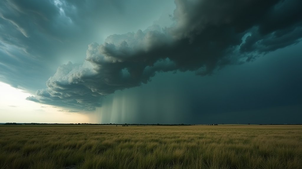
The sweltering heat that has gripped Texas for the better part of the summer is finally set to undergo a dramatic transformation. Meteorologists tracking a robust cold front moving south across the plains report that the system is colliding with the lingering, humid air mass, creating the perfect recipe for severe weather development. While residents may welcome the dip in temperatures, the transition is far from benign. The National Weather Service (NWS) has issued warnings for residents in North and South Central Texas to prepare for potential hazards, including large hail and damaging thunderstorm winds, as the front traverses the state.
Key Highlights
- Temperature Pivot: The cold front marks an end to the current streak of triple-digit heat, with forecasts predicting a shift toward more moderate, seasonal temperatures.
- Severe Weather Threat: The primary concerns accompanying this shift are isolated severe thunderstorms capable of producing large hail and wind gusts exceeding 60 mph.
- Geographic Impact: North Texas and the I-35 corridor through South Central Texas are currently identified as the primary zones of concern for storm development.
- Power Grid Resilience: Officials are monitoring the potential for localized power outages caused by high winds and lightning, though the reduced heat load is expected to lower overall energy demand.
The Meteorological Clash: Why Texas is Seeing Storms
The current weather pattern is a classic meteorological setup: a strong, mid-latitude trough is forcing cooler, drier air into a region dominated by high-pressure, hot air. When this cold air mass encroaches upon the superheated, moisture-laden atmosphere of Texas, the warm air is forced upward rapidly. This process, known as convection, acts as the engine for thunderstorm formation.
Meteorologists from the Storm Prediction Center (SPC) have noted that the instability index is quite high in the affected regions. The “cap”—a layer of warm air that often prevents storms from forming—is expected to break or weaken significantly as the front pushes through. This creates a volatile environment where updrafts can intensify quickly, supporting the growth of large, damaging hail. For Texans accustomed to the slow, stagnant heat of summer, this rapid change in weather is a stark reminder of the state’s potential for extreme atmospheric volatility.
Regional Impact Zones and Timing
North Texas and the Metroplex:
For the Dallas-Fort Worth area and surrounding counties, the danger is expected to materialize in the late afternoon and early evening hours. The line of storms is anticipated to move from northwest to southeast. Residents should monitor local weather alerts, as rapidly developing cells could become severe with little warning. The focus here is on damaging wind gusts that could impact trees and power infrastructure.
South Central Texas (The I-35 Corridor):
As the front advances toward Austin, San Antonio, and the surrounding Hill Country, it is expected to maintain its potency. This region is particularly sensitive to sudden shifts in wind direction. The hilly terrain of the region often interacts with storm fronts in complex ways, potentially enhancing localized rainfall totals. While the moisture is beneficial for drought-stricken areas, the intensity of the downpours may lead to localized, short-duration flooding, particularly in urban areas with high percentages of impervious surface.
Hazards and Safety Preparations
The Hail Threat
Large hail is one of the most unpredictable elements of these thunderstorms. Even within a moderate storm, hail can develop rapidly if updrafts remain strong. Property owners are advised to move vehicles into garages or covered parking. If hail begins to fall, avoid standing near windows or sliding glass doors, as the potential for breakage is significant.
Managing Power Outages
While the cold front will lower the demand for electricity, the physical integrity of the grid remains a vulnerability. Thunderstorms are often accompanied by cloud-to-ground lightning and microbursts. In recent years, Texas infrastructure has faced significant scrutiny. While grid operators (ERCOT) generally handle lower demand periods better, localized distribution lines remain susceptible to falling branches and direct lightning strikes. Residents should have emergency kits ready, including flashlights, batteries, and portable chargers, in the event of brief power interruptions.
Secondary Angles: Understanding the Wider Context
1. Energy Grid Dynamics
It is an ironic reality of Texas weather that the very system that relieves the stress of a heatwave can also threaten the delivery of power. While extreme heat causes transmission lines to sag and equipment to overheat, thunderstorms introduce the risk of physical damage. However, the overall reduction in air conditioning load is statistically significant, providing a temporary “breathing room” for the grid, allowing maintenance crews to address any issues caused by the storm front without the extreme pressure of an energy emergency.
2. Agricultural Resilience and Impact
For the agricultural sector, this cold front is a double-edged sword. Much of Texas has been grappling with prolonged dryness. The rainfall associated with these storms could provide much-needed hydration for crops and grazing lands. However, the hail threat poses a direct risk to late-season crops. Agronomists often warn that a few minutes of hail can destroy an entire season’s worth of harvest in a localized area. Farmers are encouraged to utilize wind machines and protective netting where applicable, though the scale of the storms often limits the effectiveness of such measures.
3. Climate Patterns and Extreme Variability
Meteorologists are increasingly studying the trend of “weather whiplash” in Texas. This refers to the rapid transition from record-breaking heat to severe, violent weather. This pattern may be indicative of broader changes in atmospheric circulation, where the jet stream becomes more “wavy,” allowing polar air to penetrate further south than historically common during the summer months. This phenomenon challenges local planners and urban engineers to design infrastructure that is more resilient to rapid, high-impact events rather than just sustained, slow-moving heat domes.
FAQ: People Also Ask
Q: How long will the cooler temperatures last?
A: The relief provided by this cold front is generally transient. Forecast models suggest that while temperatures will drop below the triple-digit threshold for 48 to 72 hours, high pressure is likely to rebuild by the weekend, slowly returning the region to typical summer heat patterns.
Q: Should I be concerned about flooding?
A: While the primary threat is severe wind and hail, any heavy downpour in an urban environment carries a risk of localized flooding. If you encounter water across a roadway, the golden rule remains: “Turn Around, Don’t Drown.”
Q: Is this cold front related to hurricane season?
A: No. This is a continental weather system driven by a low-pressure trough in the upper atmosphere. It is distinct from tropical activity in the Gulf of Mexico, although meteorologists are always monitoring the Gulf for moisture transport that could fuel these types of storms.
Q: Where can I get the most accurate, real-time updates?
A: For immediate safety, rely on official NWS alerts, NOAA weather radio, or trusted local television meteorologists who have access to high-resolution local radar. Avoid relying solely on social media algorithms for time-sensitive safety warnings.